 For all the changes it's undergone over the last century, Corktown remains one of those Toronto neighbourhoods that shows off its historical character well. That is, if you know where to look. Along with landmarks like the Enoch Turner Schoolhouse and St. Paul's Basilica, short streets like Bright, Ashby Place and Wilkins Avenue offer some of the best examples of 19th century row-housing in the city. It's difficult to stroll along them and not imagine Toronto as it once was.
Although the general consensus is that the neighbourhood took its name on account of the famine-fleeing Irish immigrants who took up residence here in order to be close to the various breweries, brickyards and mills in the vicinity, some have speculated that the preponderance of cork from nearby distilleries might have some etymological significance as well. I doubt it, but it's an interesting enough theory.
Life in Corktown at the turn of the century were anything but rosy. While the remaining historical homes look quaint today, the area was once dotted with slum housing occupied by poverty-stricken residents. The bulk of the photographs below, in fact, were taken by Toronto's public health department, which was tasked with documenting the conditions in the neighbourhood.
Certainly one of the busiest places in Corktown during this period was the House of Providence, a Catholic charity that still exists to this day. Originally housed in a majestic building on Power Street that opened in 1857, the institution provided care and support for the many downtrodden residents of the area. In somewhat typical Toronto fashion, the structure was demolished in 1962 to make way for the Richmond off-ramp from the Don Valley Parkway. Along with the loss of the House of Providence, DVP-related construction wiped out hundreds of historic homes in Corktown.
Today the neighbourhood is in the midst of widespread redevelopment. Along with the condos that have popped up on King East over the last few years, the nearby West Don Lands development is set to completely transform the area to the southeast, which is bound to have a ripple effect on the streets to the west.
There's a certain lazy quality to King Street between Parliament and River streets, which always gets me in a historical state of mind, but this latest influx of residents to the area might very well serve to make the streetscape more vibrant — and that's nothing to complain about. If anyone suggests messing with Bright Street and Ashby Place, on the other hand, I won't be a happy camper.
See also:
What Queen East used to look like in Toronto
When the Distillery District produced booze and bombs
MAPS
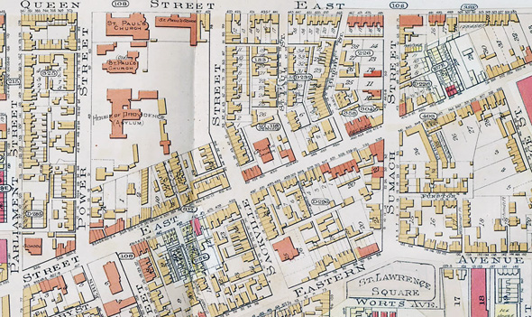 Goad's Atlas, 1903
 Google Satellite View, present day
IMAGES
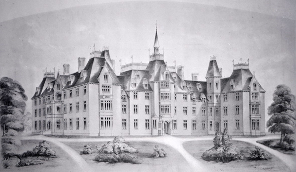 House of Providence, opened 1857
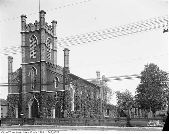 Trinity Church, 1900s
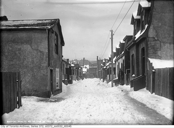 Gilead Place, 1912
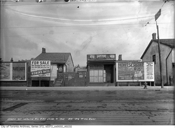 512-516 King East, 1913
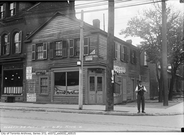 487 King Street, 1917
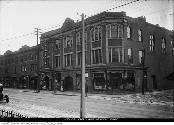 Queen and Tracy streets, 1919
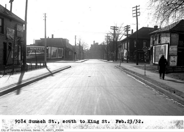 Sumach Street looking south to King, 1932
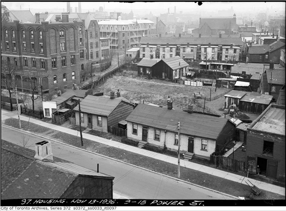 Above 9-15 Power Street (House of Providence to the left), 1936
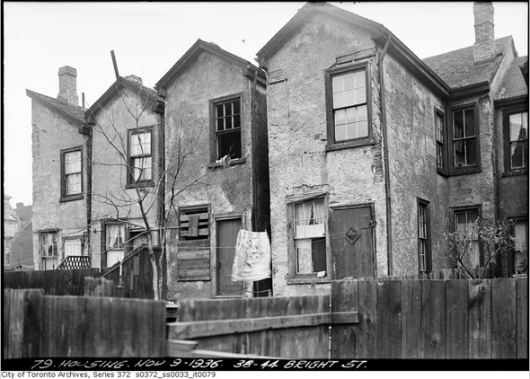 38-44 Bright Street, 1936
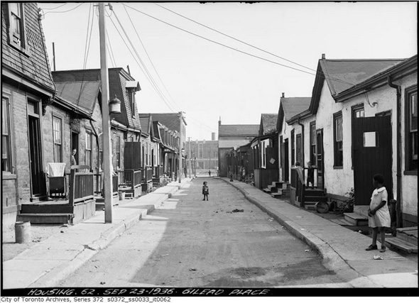 Gilead Place, 1936
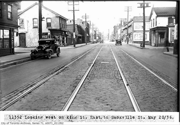 King looking west at Sackville, 1936
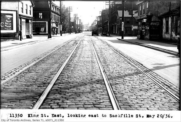 Ling looking east at Sackville, 1936
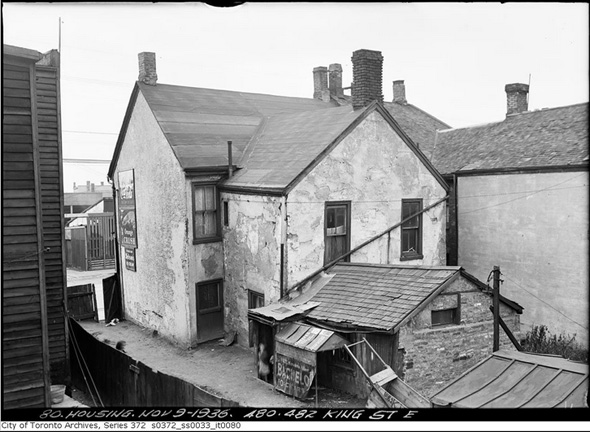 480-482 King Street East, 1936
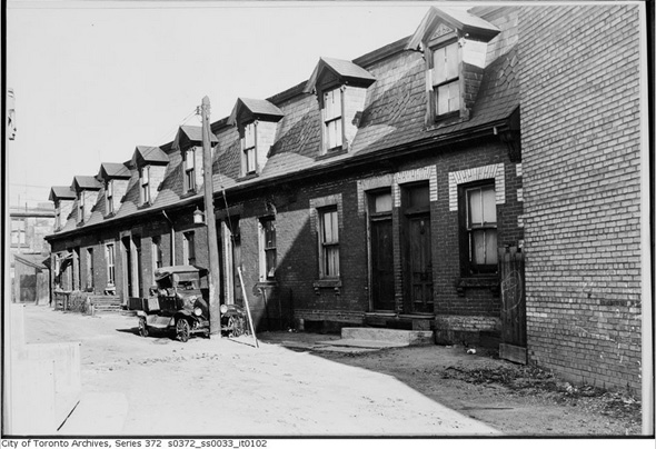 Percy Street, 1936
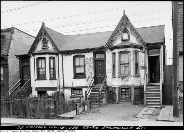 22-26 Sackville Street, 1936
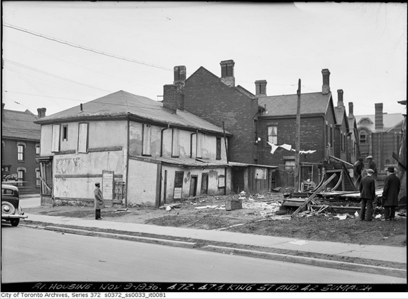 King and Sumach, 1936
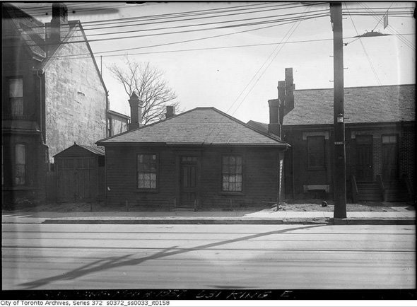 531 King Street East, 1937
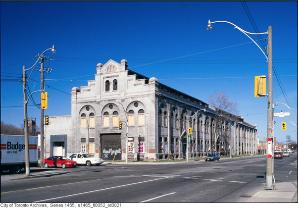 Former Consumers' Gas Co, Station A — now 51 Division (shot ca. 1990s)
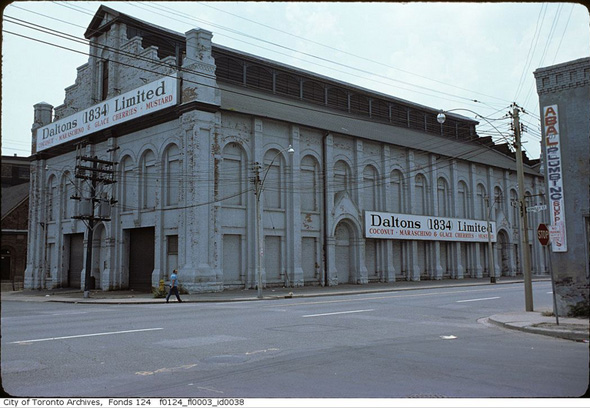 What is now the Canadian Opera Company (227 Front Street East)
 I initially thought this was Ashby Place, but now I doubt it. Suggestions (ca. early 1990s)?
 Here's the above photo of Percy Street flipped horizontally. Thanks to the first commenter.
MORE PHOTOS
In addition to the images above, I'd be remiss not to direct some attention to the great resource that Laurence Lui of the Corktown Residents & Business Association has put together. It features numerous photos not collected above and, perhaps best of all, plots them all on a map of the neighbourhood. Nicely done.