 Eglinton Avenue, once called the 3rd Concession through its Toronto stretch, felt like the end of civilization in Toronto at around the turn of the 20th century. But, like the rest of the city, development in the years to follow was swift and by the 1930s, the character of the street as a retail strip around Yonge and westward was already well in place. Walking around the Eglinton and Avenue Road area today, it's easy to discern the street's lineage even as newer buildings have gradually come onto the scene.
The street is named after the Earl of Eglinton and Eglinton Castle, which underscores the Scottish roots of those living around Yonge Street and the 3rd Concession in the late 19th century. A muddy road into the 1920s, Eglinton's big growth spurt would take place between 1930 and 1960, during which period the street was widened to its current size and bridges were built across the Don Valley.
Photographs of the street between Bayview and Laird in the 1950s, a stretch which is a mix of residential and retail storefronts, show how little that portion of Leaside has changed, even as Laird itself is in the midst of almost complete redevelopment. Further east around what's called the Golden Mile, the 1950s saw farmland replaced by strip malls and mid-size apartment complexes.
Fast forward to the 1990s and Eglinton could have once again seen a boom to rival its mid-century rise. An Eglinton subway was under construction in 1994 until Mike Harris replaced Bob Rae as Ontario Premier and killed the project. After a nearly 20 year wait, construction is once again underway for rapid transit in the form of the Crosstown LRT. With it, you can bet that the street will once again undergo significant change. If early plans are any indication, it all looks very promising.
 Eglinton & Yonge (looking west), 1922
 Eglinton & Black Creek, 1929
 Eglinton looking across Weston, 1929
 Eglinton looking east from Kodak Plant, 1929
 Eglinton & Oriole Parkway, 1930
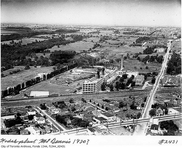 Aerial of Eglinton and Keele area (Mount Dennis), 1930
 Eglinton & Yonge, 1930
 Eglinton & Avenue, 1935
 Eglinton between Oriole Parkway and Avenue Road, 1936
 Eglinton & Bathurst, 1953
 Eglinton & Victoria Park, 1949
 Eglinton and Don Mills, early 1950s
 Power Supermarket Eglinton West,1955
 Eglinton & Hanna, 1955
 Eglinton & Sutherland, 1956
 Eglinton & Laird, 1956
 Eglinton & Laird, alternate view
 Eglinton looking east from Oswego, 1960s
 Eglinton & Yonge at night, 1962
 Eglinton Station bus bays, 1967
 Aerial of Yonge & Eglinton, 1969
 Eglinton & Victoria Park, 1969
 Allen Road looking towards Eglinton, 1978
 Leslie Bus at Eglinton & Yonge, early 1980s
 Eglinton Avenue East looking towards Don Mills, 1980s
 Eglinton & Avenue, 1990s
Photos from the Toronto Archives